Note: indicated routes are approximate. Use official topographic maps for navigation.
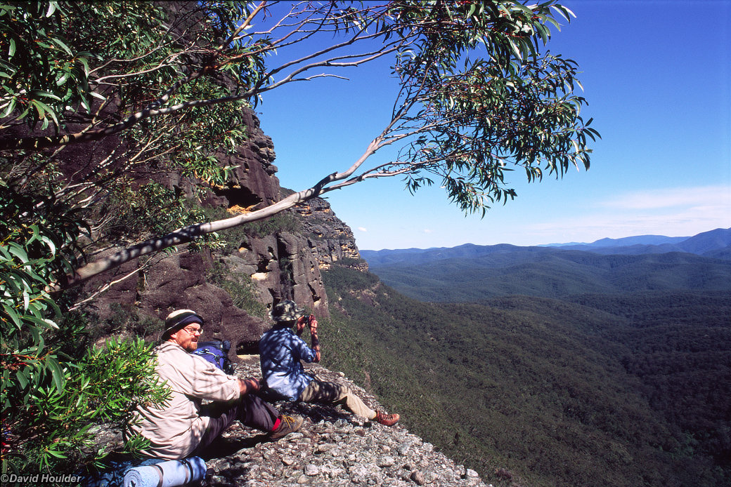
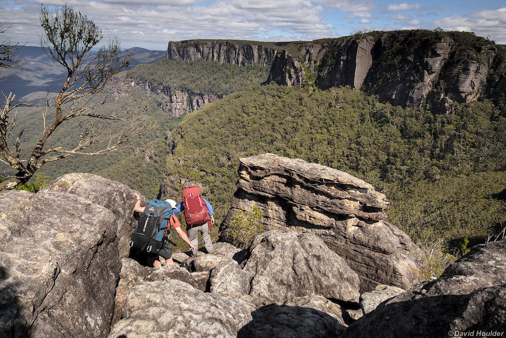
This may be the most popular walk in the whole park, and it certainly is spectacular. It's a bit of a slog though — the top of The Castle is more than 700m higher than Yadboro River — and you'll definitely need a head for heights and good rock scrambling abilities near the top. If you're freaked out by heights, this is not a walk for you as some of the bits near the top are quite exposed.
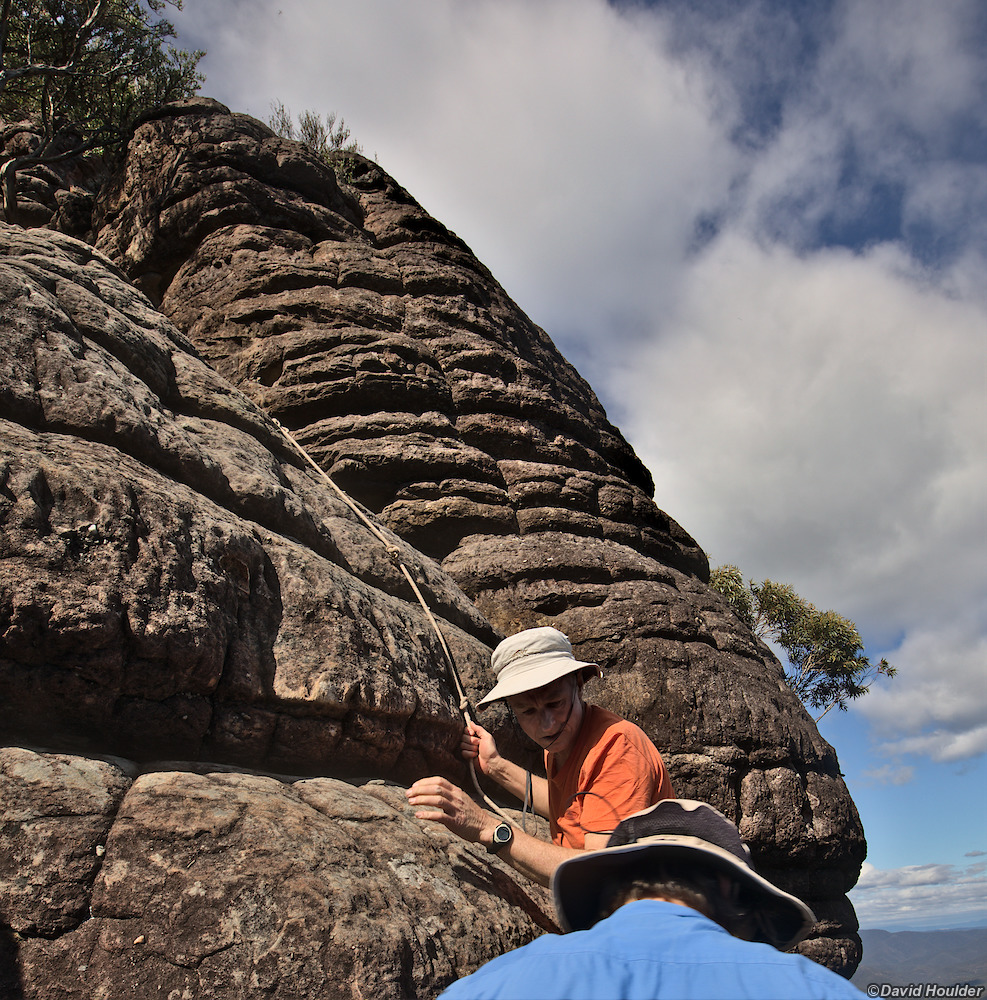
There are several places near the top of the ascent where ropes have been installed by previous visitors, but they are not part of any official infrastructure. Use them at your own risk. I recommend bringing your own 5m length of rope, especially if you're taking a full walking pack up there.
It's possible to do the trip in one long day, but be warned that the track along the base of the cliff is slower than you might expect, and the final ascent can take a long time, especially if you have a large party. Keep an eye on the clock and if you use up half your walking hours before reaching the top, turn around.
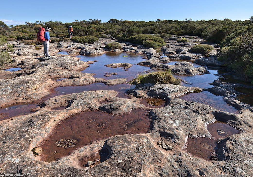
Once you leave the Yadboro River, there's basically no running water on this trip unless you detour to Cooyoyo Creek after reaching the saddle, and even that may not be running during a dry period. Cooyoyo Creek also has a toilet block.
You can break the walk down into 4 stages:
- Up Kaliana Ridge from the Long Gully carpark to
the base of The Castle.
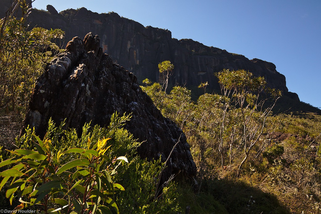
You have to cross the Yadboro River just after leaving the carpark, but it's very shallow at that point and you may even be able to get across without taking your boots off. The ridge track is easy walking, but uphill pretty much all the way. At the southern end of The Castle there are some steps and a steep slope with metal chains that lead to the base of the cliff. - The track along the base of the cliff on the
western side.
This is undulating, and eroded in parts with lots of exposed tree roots. Not particularly difficult, but a little slow. - The walk up to the saddle between The Castle and
Mt Nibelung.
There is a turnoff to the right on this section that will take you a little more directly to The Castle through a tunnel in the "tail", but the tunnel is a tight squeeze and I doubt it saves much time. - The final, very steep ascent up the
north-eastern flank of The Castle "tail" through Meakins Pass.
This is more of a climb than a walk.
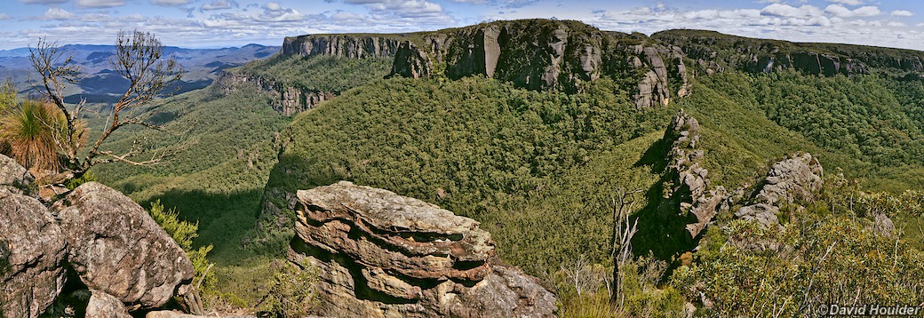
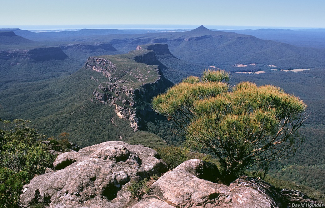
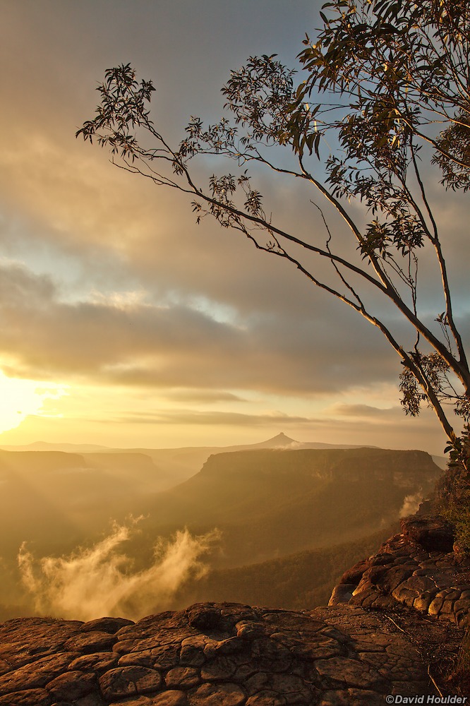
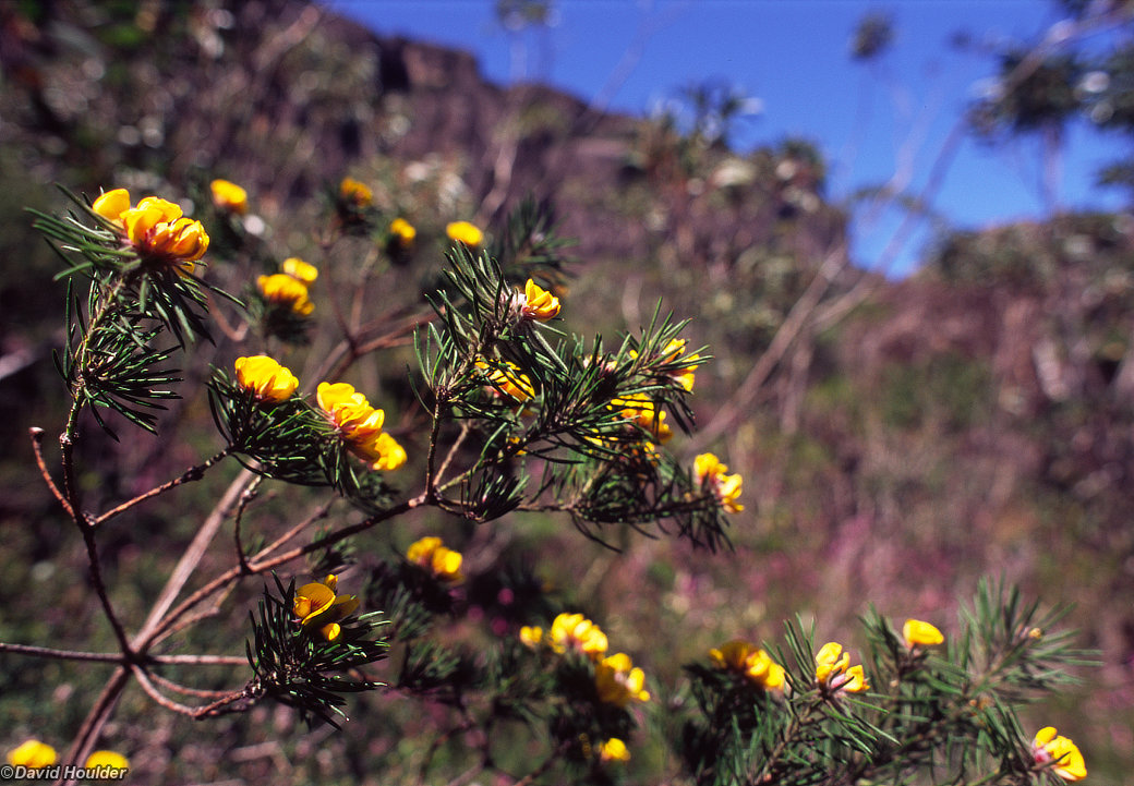
Once on top you will have some spectacular views, weather permitting.
Camping on top is a bit challenging. For starters, it's all rock and heath, and you will not be able to get tent pegs in anywhere. There are some usable flat sections of rock here and there, but they tend to have protruding sharp bits that may puncture your sleeping mat if you're not careful. There is no reliable water, but after rain there may be water in rockpools. It's also very exposed, and can get extremely windy, and if something blows away it may blow right off the edge. Consider making a toilet stop at Cooyoyo Creek before climbing up, as the topsoil on the Castle is so thin I doubt you could dig an acceptable hole anywhere.
The images for this walk are from at least three separate trips. The earliest date from 1993 when I went on my first dedicated landscape photography trip organised through PhotoAccess.
Note: The map above is just a rough guide. The marked locations and route may be highly inaccurate. If you want to do this walk, get hold of the proper topographic maps and use them to plan your walk in conjunction with a reputable guide book.