View
East Gippsland Loop in a larger map
East Gippsland Loop
In 2013, the PedalPower "Spring Scenic Tour" was a nine-day loop through East Gippsland, starting at Bondi Forest Lodge, near Bombala in southern New South Wales. From there we headed south to the coast through Errinundra National Park, east to Mallacoota, then back to Bondi Forest. The northern part of this loop is through densely forested areas, so I wasn't too surprised that the start and end of the trip were a bit wet. I was surprised by the fact that it snowed on the second day though - in November.
The original plan was to make use of some of the less well-known tracks around the coast and north-west of Genoa - shown in grey on the map above. By the time we got to Wingan Inlet though, we realised that the schedule was looking a bit too tight to comfortably accommodate a lot of bush-bashing on poorly maintained tracks. In the end we ended up doing quite a lot more bitumen riding than originally planned, but the traffic was pretty light, even on the highway.
The route 🔗
- Day 1: Bondi Forest Lodge to Delegate River campground
- Day 2: Delegate River to Ada River campground
- Day 3: Ada River to Bemm River (coastal town)
- Day 4: Bemm River to Thurra River campground
- Day 5: Thurra River to Wingan Inlet campground
- Day 6: Wingan Inlet to Mallacoota
- Day 7: Rest day in Mallacoota
- Day 8: Mallacoota to Imlay Creek
- Day 9: Imlay Creek to Bondi Forest Lodge
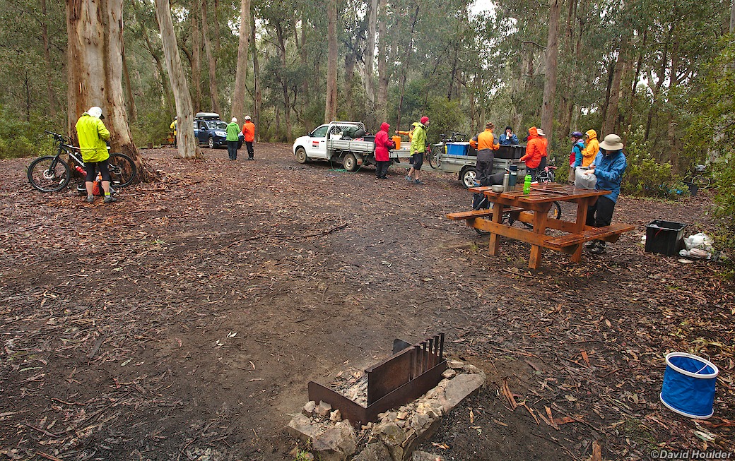
We used a support vehicle (a ute with a box trailer) to transport most of our gear between campsites. Splitting the hire and fuel costs for that amongst the twenty or so riders made for a pretty cheap transport bill.
Thanks to Richard Bush for doing most of the organising.
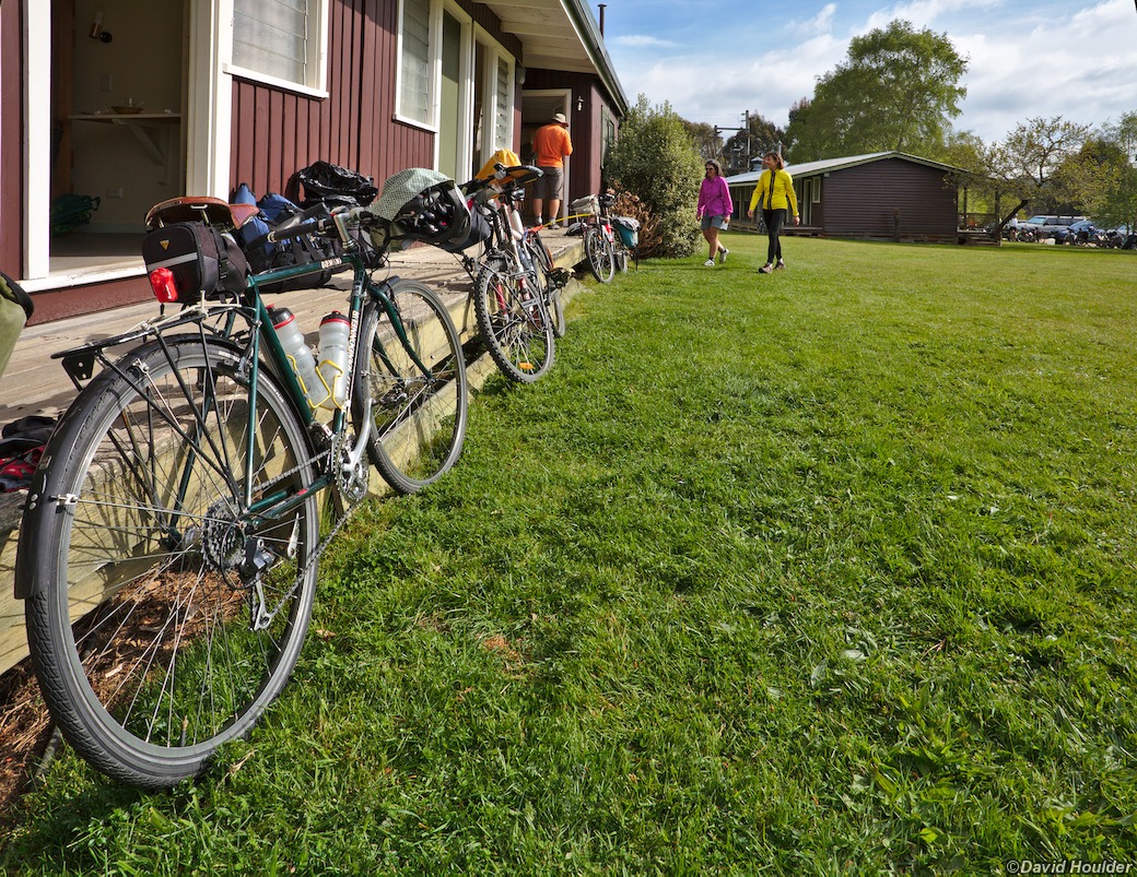
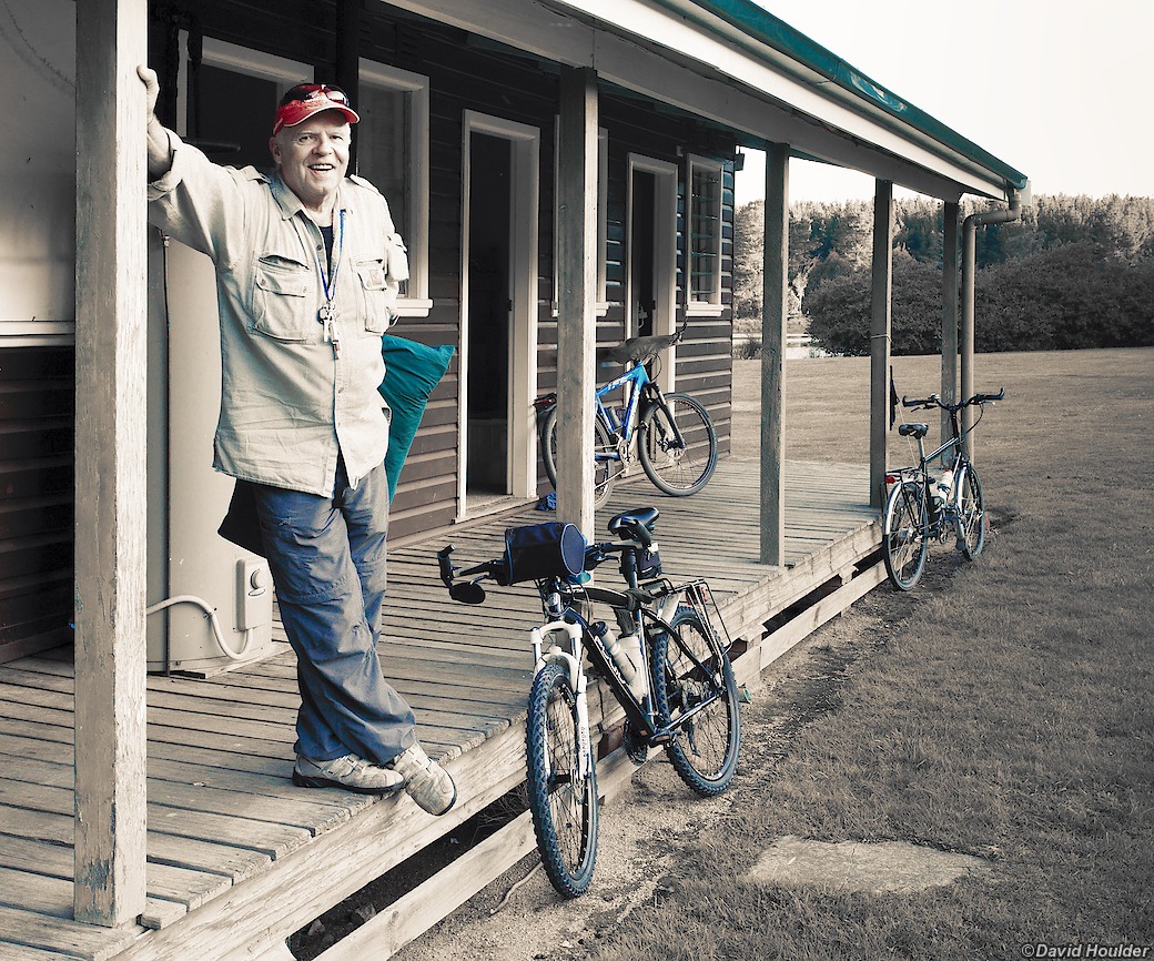
Bondi Forest Lodge is an old forest workers camp. The accommodation is pretty basic, but it's clean, has hot showers, a large communal kitchen and a separate kitchen/lounge/dining area. The grounds are spacious, with plenty of lawn and there's a large farm dam - it's quite a pretty spot.
Bondi Forest itself is a working pine forest, so it's not as picturesque as it could be. When the weather's bad and you're pedalling uphill on rough muddy tracks through kilometres of austere pine plantations and logged coupes, I'd actually describe it as grim. Maybe that's just me.
The group arrived at Bondi Forest in dribs and drabs the day before the start.
This allowed us to do some last-minute bike adjustments, have a communal dinner
and get a good night's sleep.
This is the Stevenson screen at Bondi Forest Lodge. It houses a weather station, and it's designed to keep the instruments inside protected from the weather, while keeping them at the ambient temperature and humidity. According to the Wikipedia article, it "...will usually require repainting every two years."
Day one. Weather looks OK. Distance = 0. Broken spokes = 0. Gravel rash = 0.
Late morning on day one. The weather started to get a bit chilly, but the rain
held off. By the time we got to the Bendoc pub though, it was raining steadily.
We ate lunch on the pub verandah, then headed on to Delegate River once the
rain eased.
The campsite is less than 10km from Bendoc on a nice sealed road through the
forest.
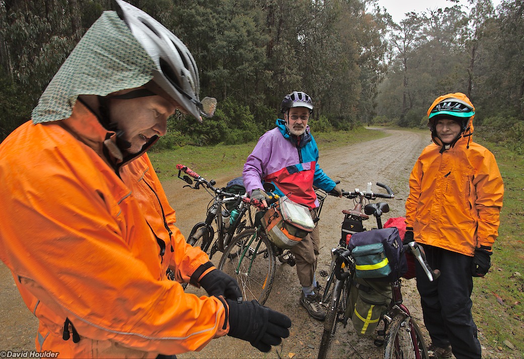
Heading down to Ada River on day two.
One of the reasons for doing this ride in November was to avoid the cold weather. No such luck this year.
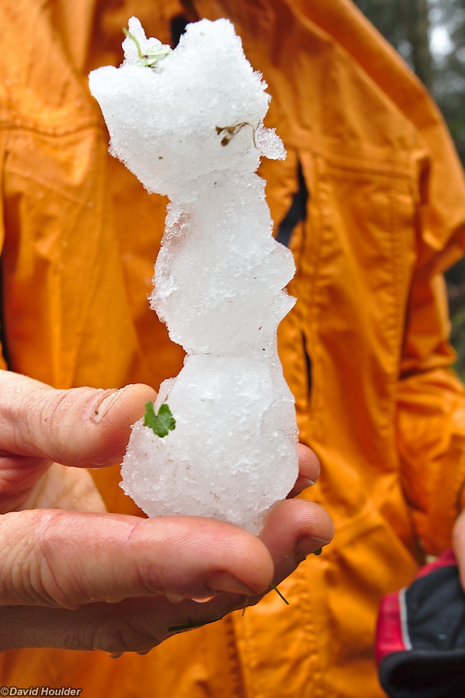
Just enough snow to make a miniature snow-Lisa-Simpson.
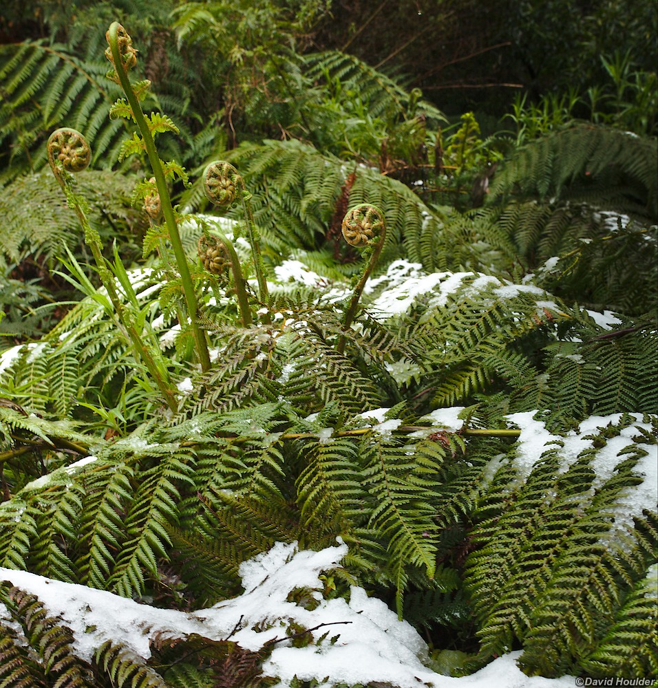

OK, it was cold but the Waratahs (Telopea oreades) were in full bloom.
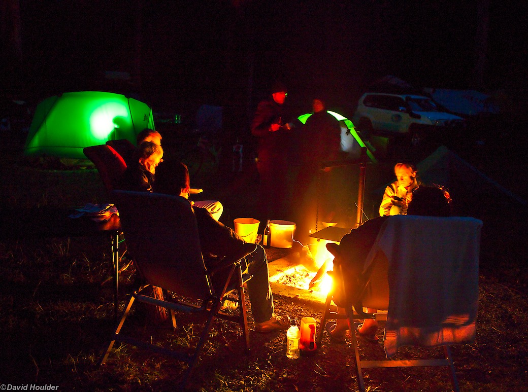
We shared the Ada River campsite with a 4WD club. They had chairs. We had moral
highground and smugness. They were more comfortable.
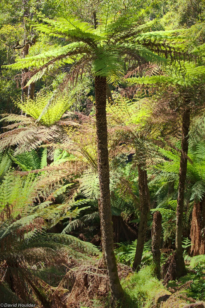
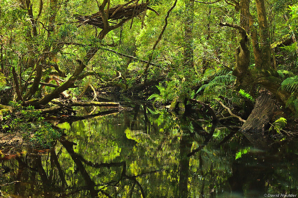
On day three, after the chilly descent from Delegate River, we had a beautiful day cycling beside the Errinundra River and on to the coast. Some of these tree ferns (Dicksonia antarctica) must be hundreds of years old. This specimen is probably around 10 metres tall. The ones in my garden grow a couple of centimetres a year.
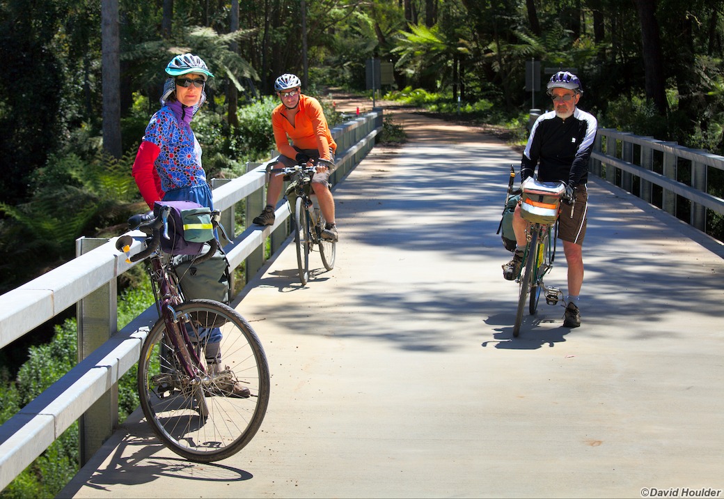
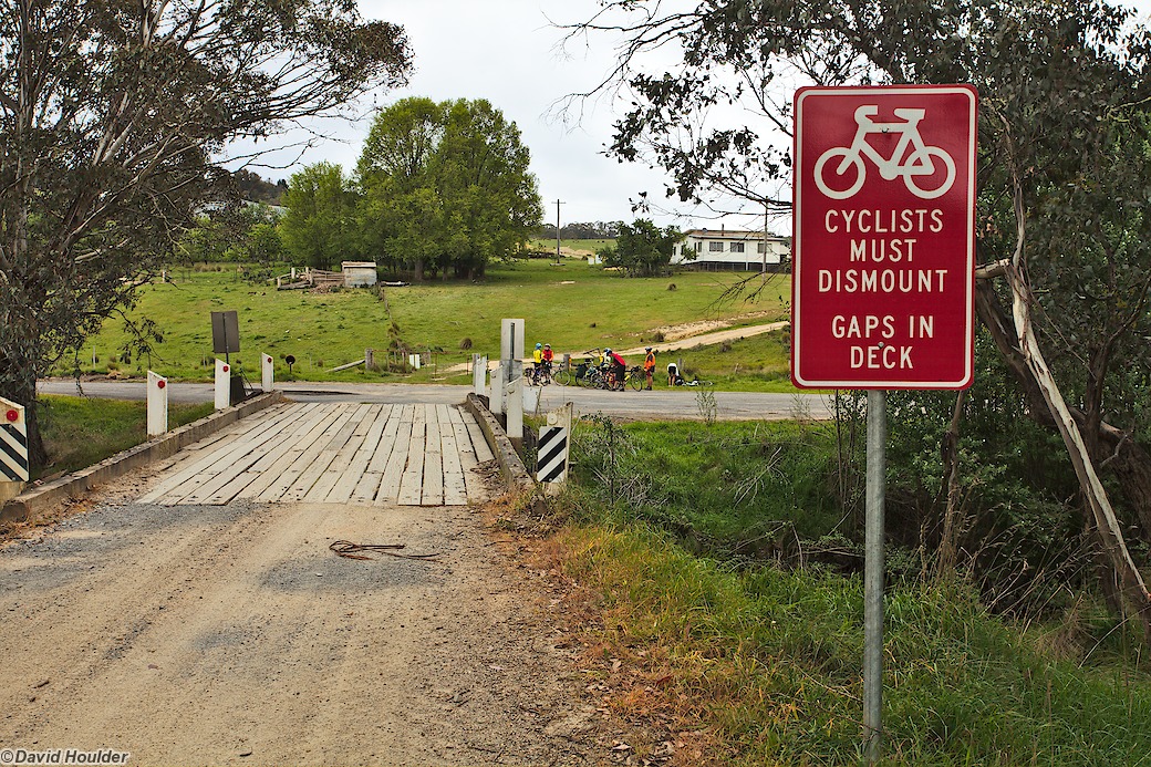
Silke, John and Doug on the bridge over the Bemm River near Club Terrace.
It's obviously a fairly new bridge. There's a reason for that...
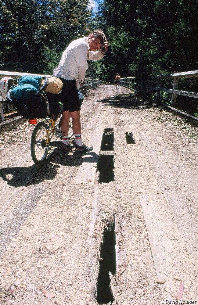
This is what the bridge looked like in 1999
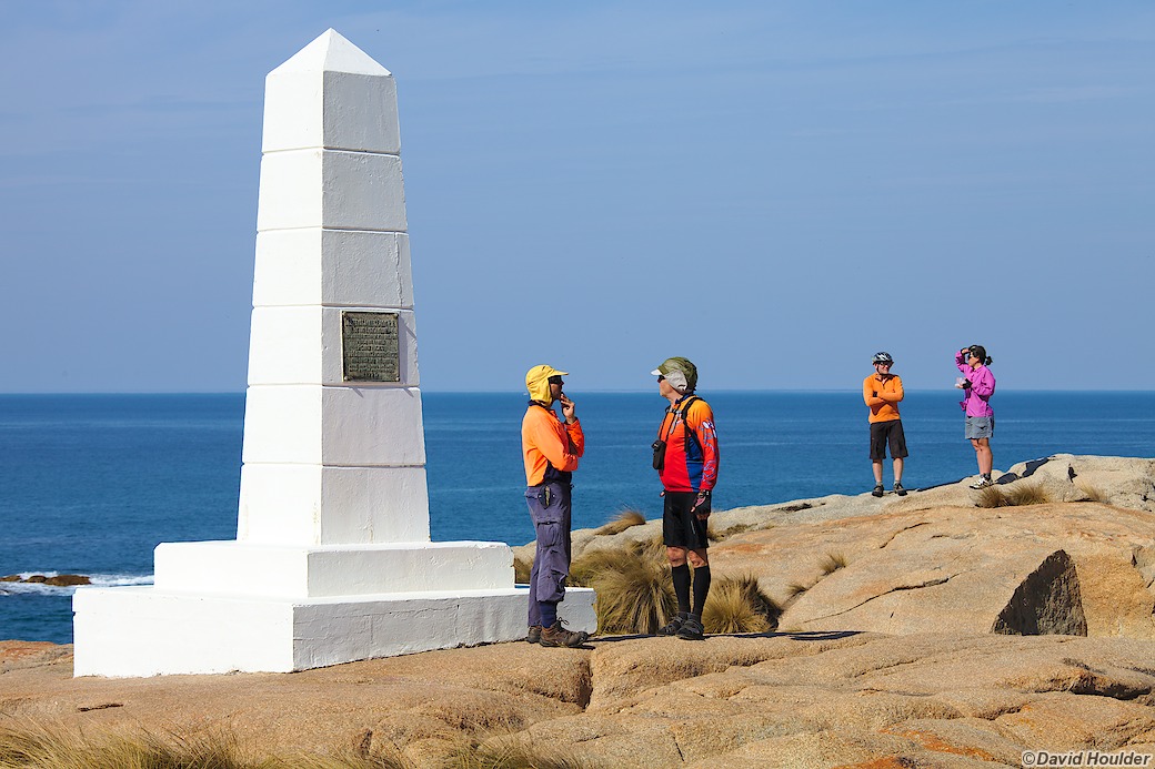
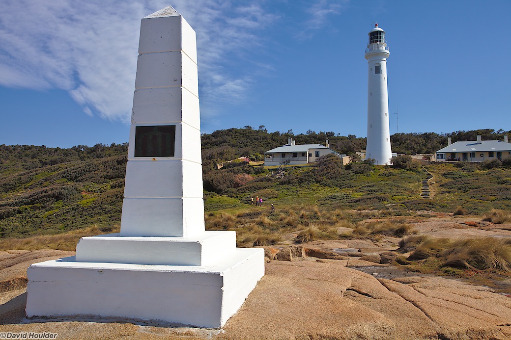
We camped at the Thurra River campsite, but in the morning we cycled a few kilometres down the beach to the Point Hicks lighthouse.
Attached to this obelisk is a plaque bearing the names of the crew of Cook's 1770 Endeavour expedition. Point Hicks was the first point on the continent they saw.
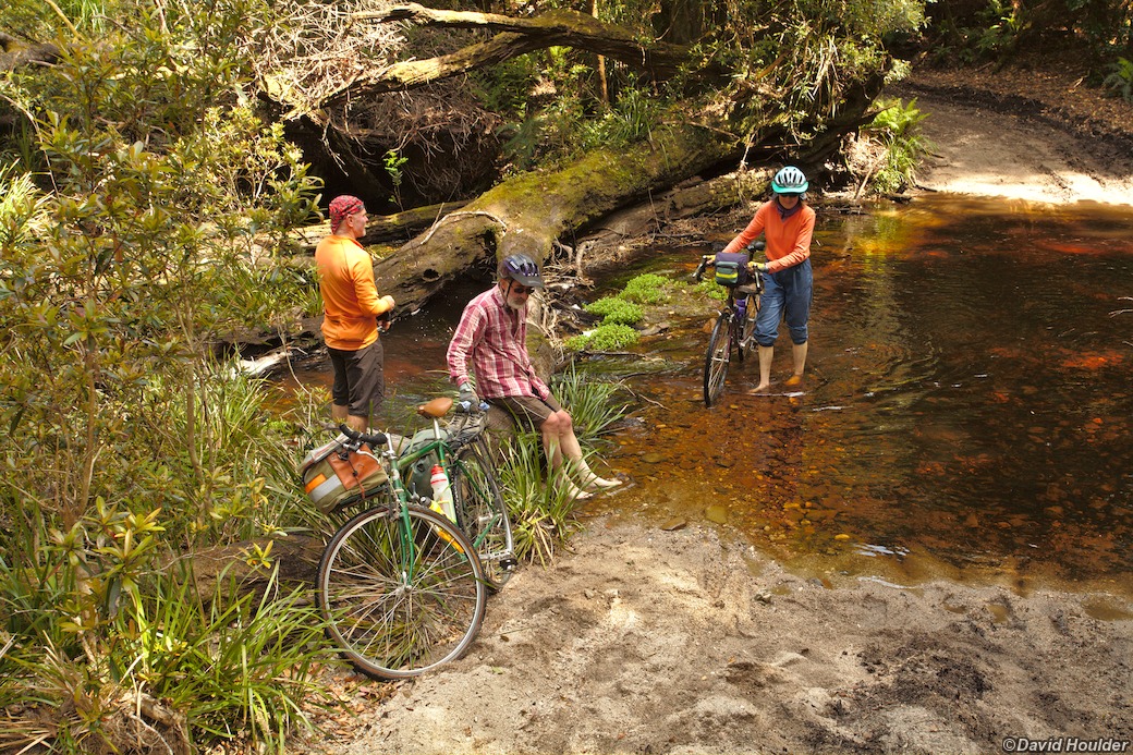
On day five, we followed Cicada Track from Thurra River to get to Wingan Inlet.
The track crosses the Mueller River at this pretty ford. Except for this
crossing, Cicada Track is pretty flat, but it's sandy in parts and littered
with sticks, making it a fairly slow and tiring trip on a bike.
The original plan was to ride from Wingan Inlet to Mallacoota on day six along tracks in the Sandpatch Wilderness area. Given that it took most of the day to ride twenty-something kilometres along Cicada Track on day five, and with the Rooftop Mallacoota-Merimbula map describing the tracks as unmaintained, overgrown and "a scrub bash", we decided to ride to Mallacoota via the highway.
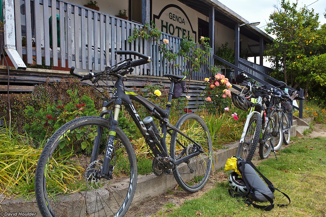
Normally I'd avoid riding along the Princes Highway, but around Genoa there was very little traffic. And the Genoa pub sells ice creams.
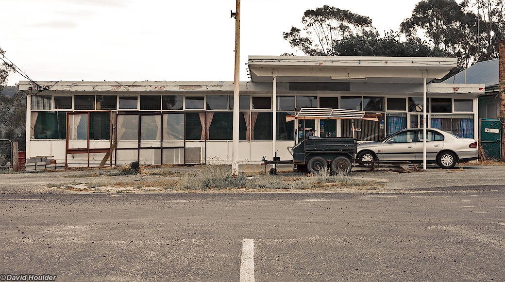
This is what happens when the highway is shifted a few hundred metres away.
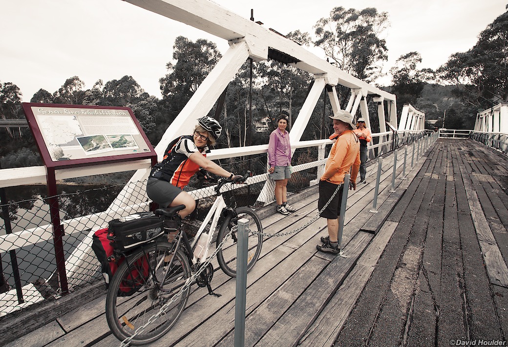
The highway used to cross this bridge, but now it's just a pedestrian and cycle bridge.
There's a nice camping area on the northern side of the bridge.
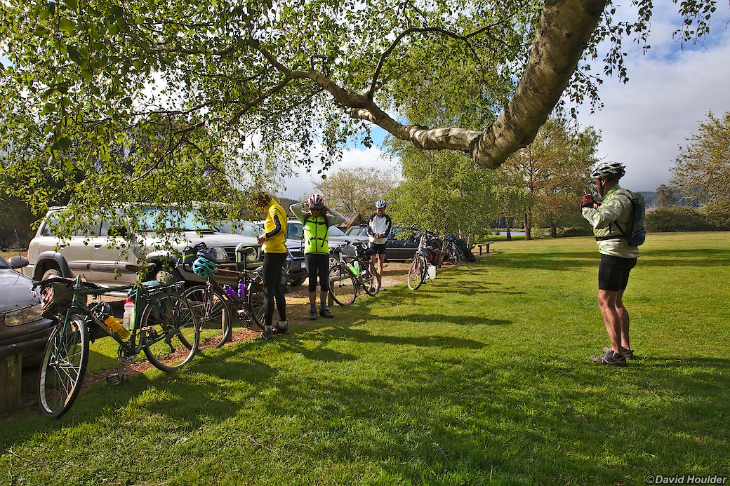
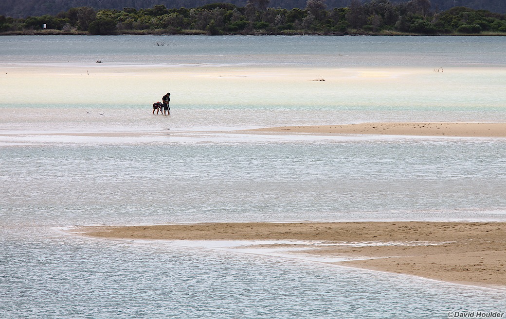
Day seven was our rest day in Mallacoota. Good use was made of the bakery and restaurants.
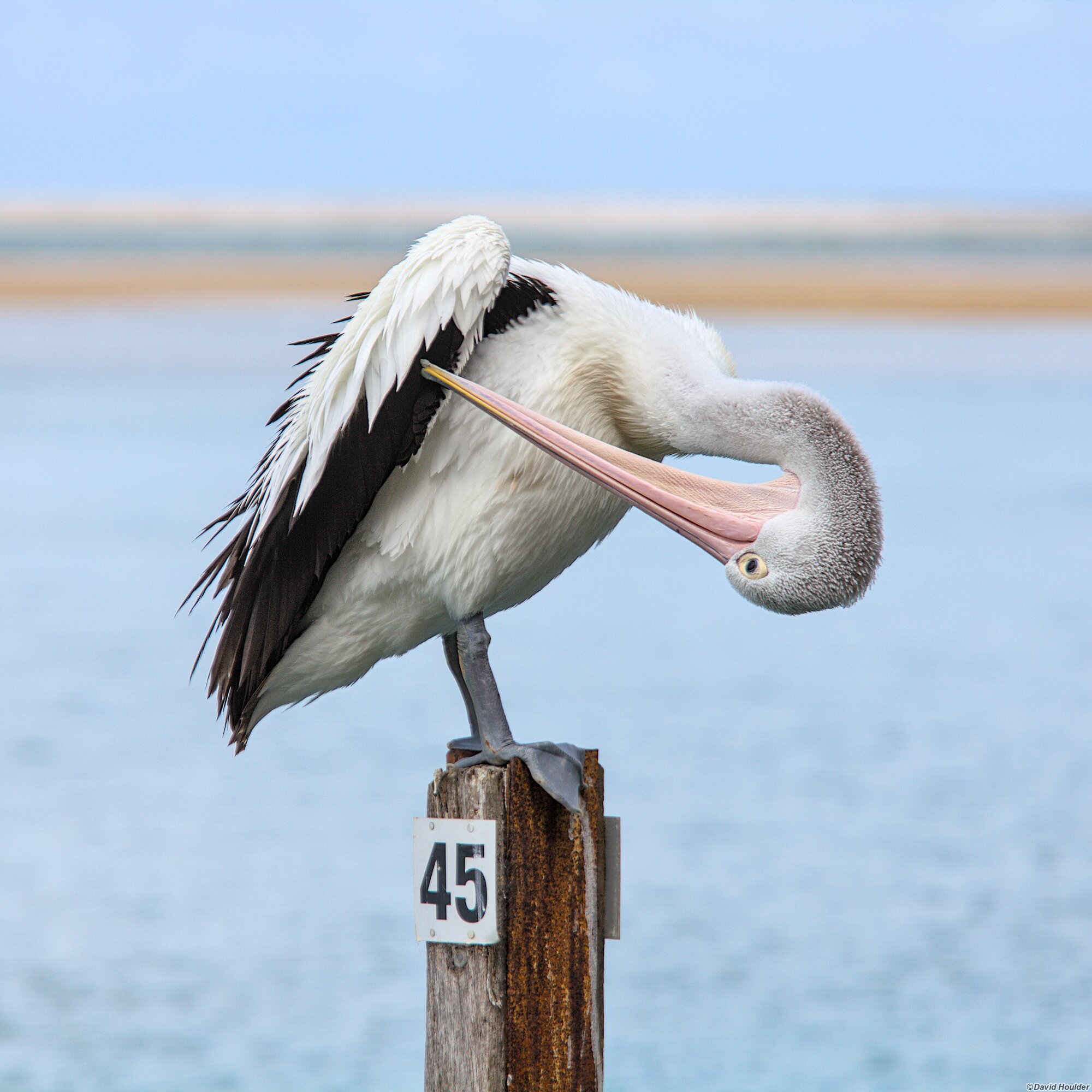
Pelicans abound in Mallacoota, but Pelican #45 was the most photogenic by a large margin.
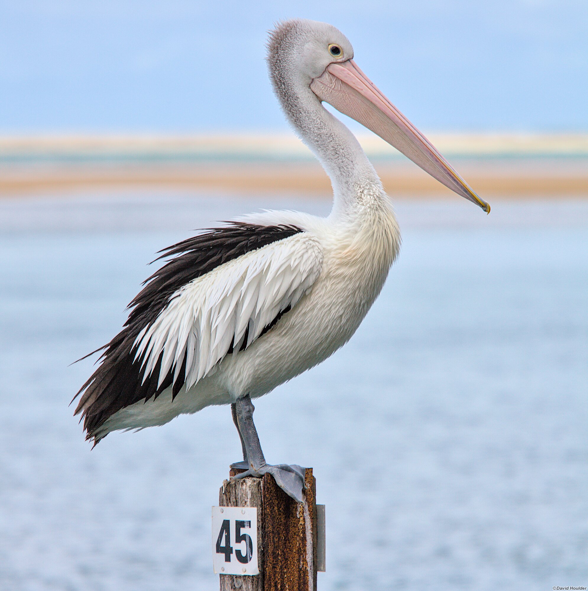
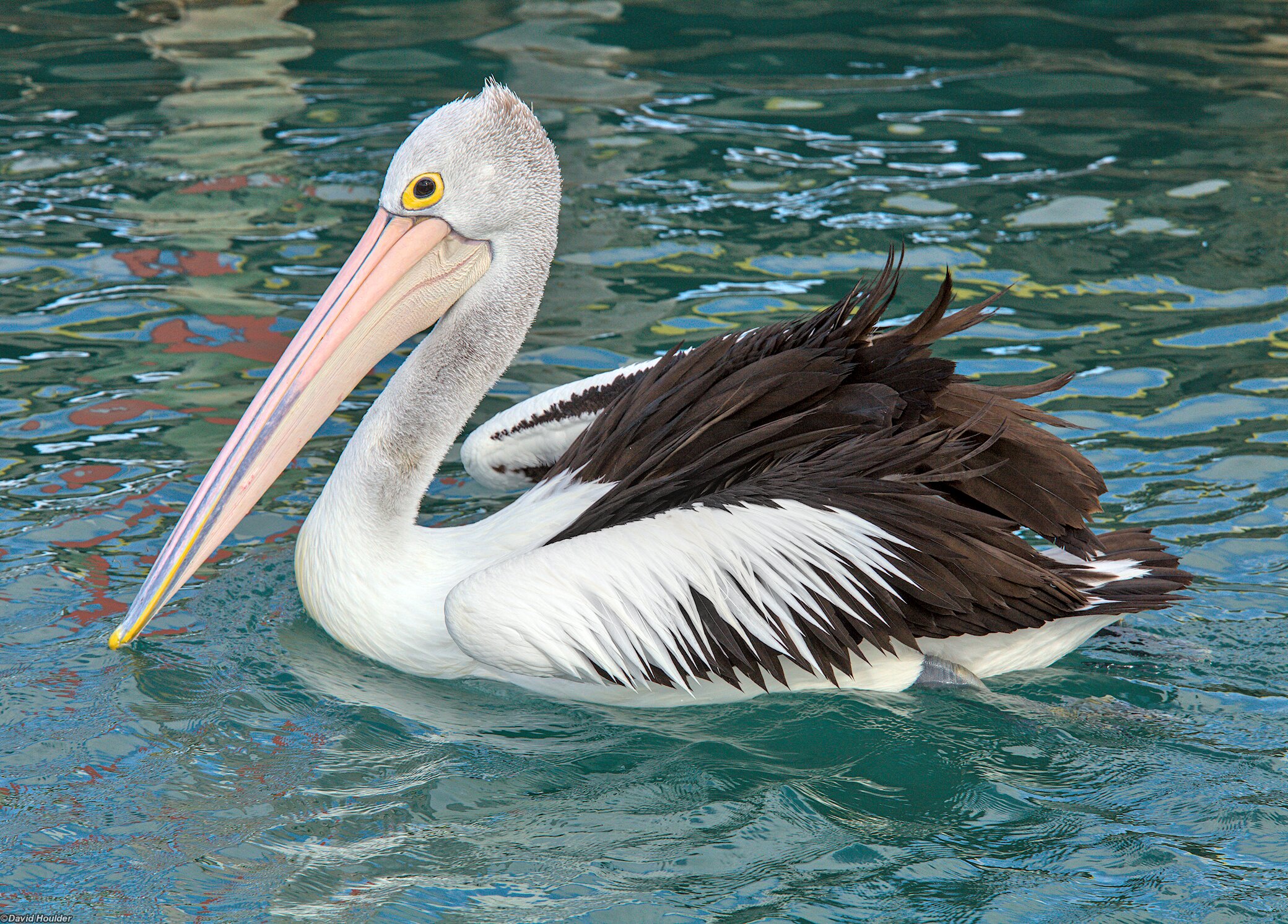
Probably not Pelican #45
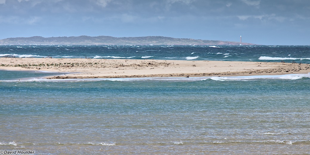
Looking north from Mallacoota
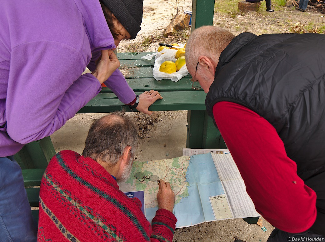
Plan A was to ride from Mallacoota back to Bondi Forest over two days, using unsealed back roads and tracks west of Genoa. With the weather forecast indicating rain, a large group of riders, and knowing that some of the tracks were probably not accessible with our 2WD support vehicle, we decided that it wasn't such a good idea.
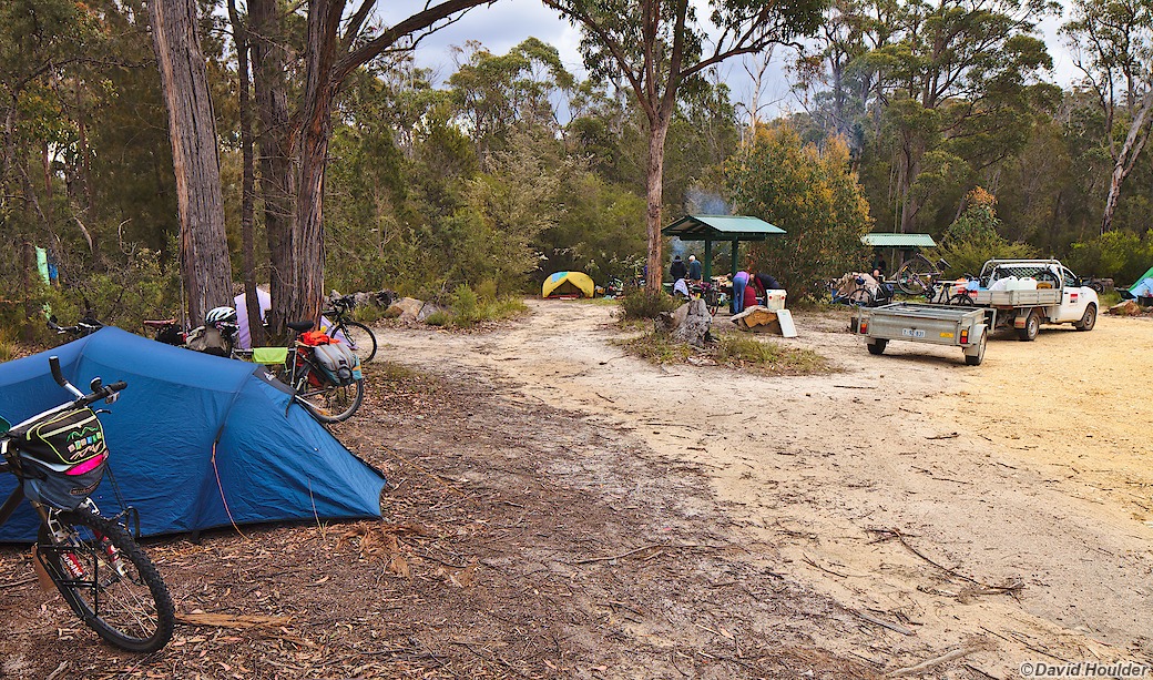
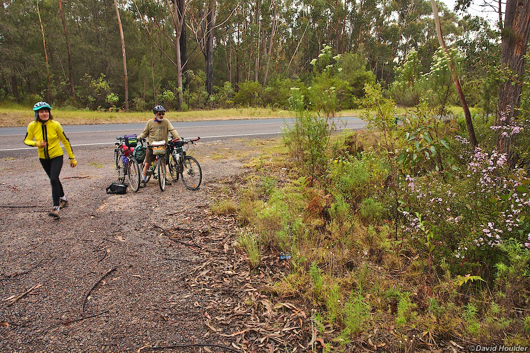
Instead, we opted for the Imlay Road route, camping at Imlay Creek for the night. On the Sunday there was almost no traffic, but a few logging trucks passed us on the Monday.
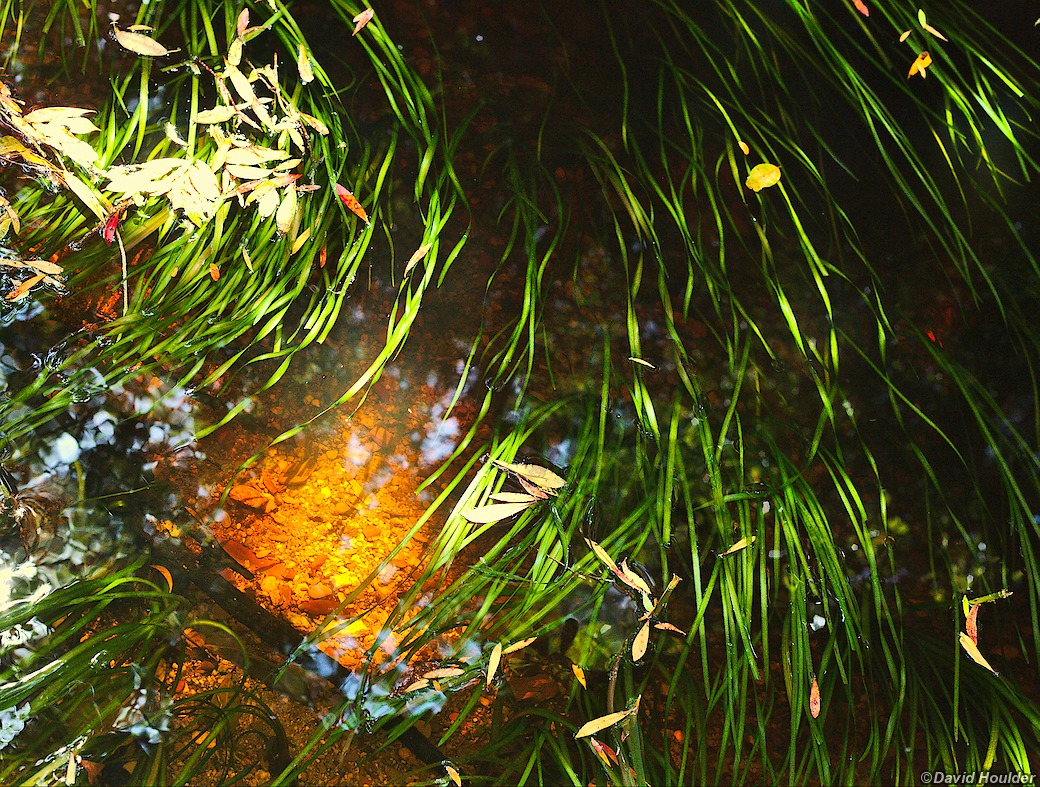
Growing around the campsite
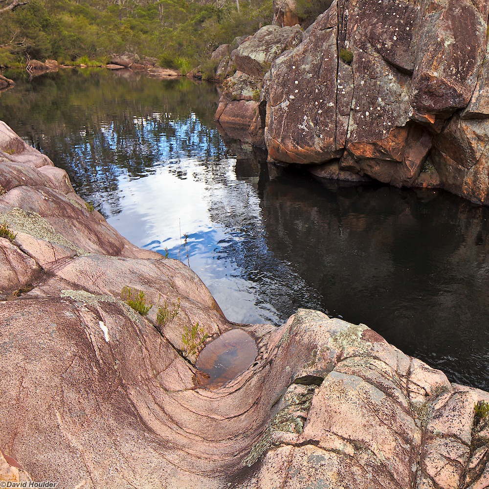
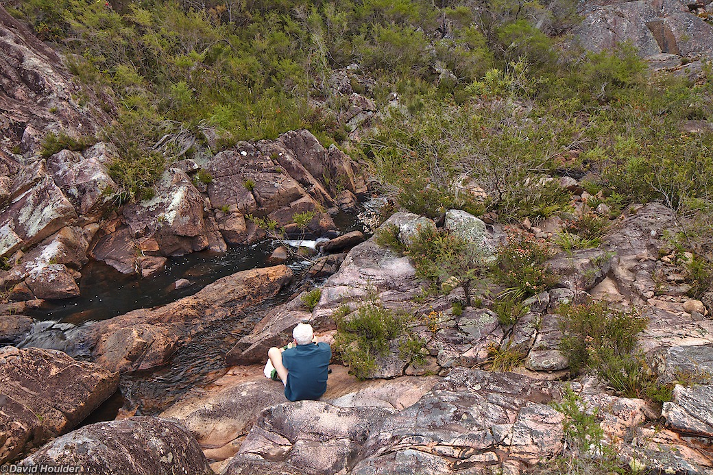
There's a great swimming hole at the Imlay Creek crossing.
The final day looked like being a long one: about 70km, uphill, in the rain and
the last half on unsealed roads through grim pine plantations. At least there
was the prospect of hot showers at the end. There was also the likelihood of
Spaghetti Bolognaise too - we made way too much on our first night at Bondi
Forest and froze the leftovers before we left.
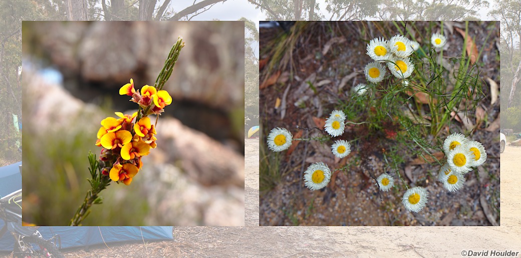
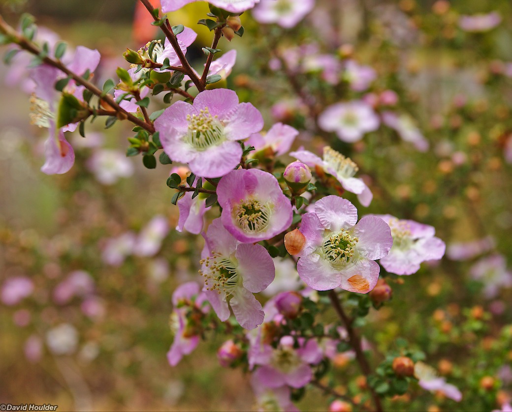
Shortly after leaving Imlay Creek on the last day we noticed these flowering
shrubs. The flowers looked almost like fruit-tree blossoms. Silke went to
investigate...
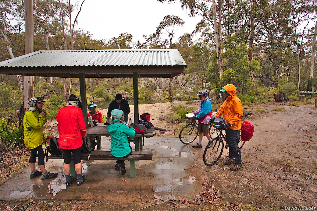
As predicted, the last day was wet. But also as predicted, there was a hot
shower and Spaghetti Bolognaise a few hours up the road.